


|
|
|||||||||||||
|
|
|
|
|
|
|||||||||
|
||||||||||||||
|
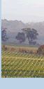
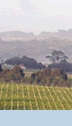
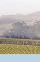
Barrymore Estate was founded in 1997 and continues a tradition of agriculture since 1845. Some of the finest grazing land was selected on the Mornington Peninsula and in 1852 Ralph Ruddell was granted a pre-emptive right of 640 acres. Cattle grazing has always been the main activity although apple and pears were grown in the early 1900’s. Our vineyards were planted in 1998 and are producing excellent quality cool climate grapes for a range of wines.
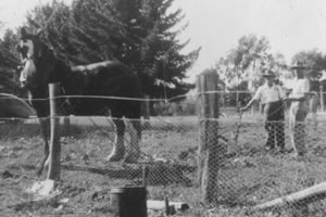
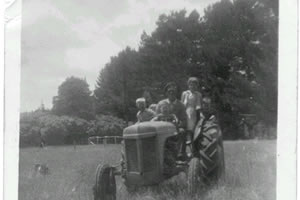
HISTORY OF BARRYMORE ESTATE Barrymore Estate is part of an area first settled in the 1840’s by William Thomas who was one of the first Europeans to occupy the region. The huge area was reduced in size to a point where in 1852 the 640 acre pre-emptive right was granted to Ralph Ruddell that contained some of the best grazing land on the Peninsula. Ralph Ruddell emigrated with his wife Isabella and family from Cork Ireland on 15 Jan 1844 aboard the bounty ship “Sea Queen”. After living in Melbourne and on the Ballarat goldfields he took over the run in1852. His neighbour was Mr Alexander Balcombe who lived at the “Briars”property. The Original name Towerong was altered to Tuerong when he obtained the title. The Tuerong run was then transferred to Vaughan and Wild in 1860. Ralph Ruddell’s wife died in 1882 leaving a family of 11 children, six of which has pre-deceased her, such were the harshness of the times. The area was again cut up into smaller parcels along the Devil Bend and Tuerong creeks and today Barrymore, Tuerong Park and Nedlands properties make up most of the original area. The original title registration details stated that the 640 acres was situated “in the colony of Victoria, County of Mornington, Parish of Moorooduc section F, and commenced at a stake marked “R” thirty seven links from a Gum tree, we believe that stake if it were still visible would be near the confluence of Devil Bend and Balcombe creeks about 1.6 Km from the house at Barrymore. At Tuerong Park opposite Barrymore , William Thomas lived as protector of aborigines in a small hut and travelled with the original inhabitants all around the Peninsula. In Volume 2B of the Victorian historical records an early photograph shows William Thomas with an aboriginal family outside his hut at Tuerong Park (Photocopy ) Maps of the region include a coastal survey (81A) by George D Smythe in 1841 clearly shows the swamps, water courses and countryside in great detail that is in part preserved at Barrymore today. Permeins maps show Ruddell’s Tuerong Run dated 1858 intersected by a road reserve to Westernport and to the Heads, this road still forms our western boundary. The property although mainly used for grazing was also
used for apple and pears in the 1920’s whilst other parts were considered
as fine kangaroo hunting areas. Evidence of the early settlers interest
in hunting was uncovered when photographs of pheasant breeding pens were
found pictured along our boundary with Nedlands farm. Mobs of kangaroo
still roam around the paddocks at dusk.
|
|
All images remain the property of Barrymore Estate Privacy Policy |
|